


Lot n° 12
Estimation :
8000 - 10000
EUR
Result with fees
Result
: 16 250EUR
CARTOGRAPHY - Collection of maps, mainly... - Lot 12 - Coutau-Bégarie
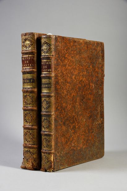
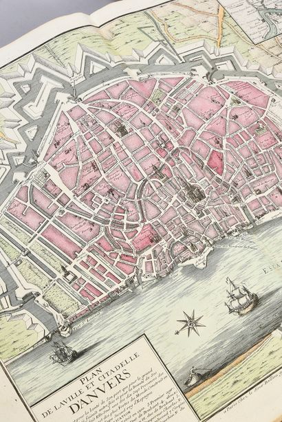
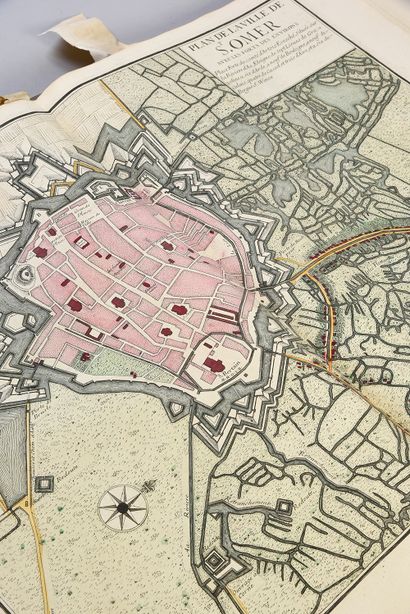
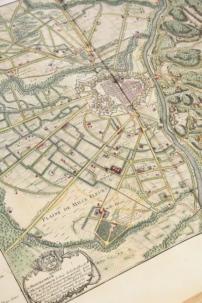
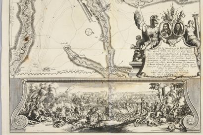
CARTOGRAPHY - Collection of maps, mainly by Jaillot, 2 volumes in-folio, full speckled calf, spine ribbed and decorated. Bindings rubbed, lower covers damaged.
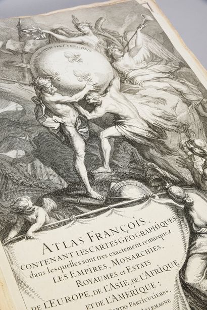
JAILLOT, Alexis-Hubert
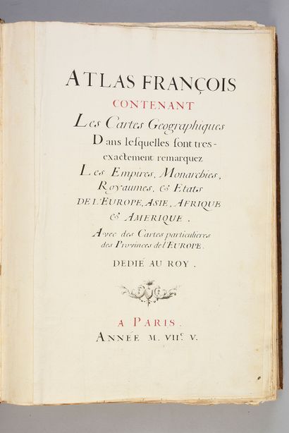
Atlas François, containing geographical maps in which are very exactly noted the empires, monarchies, kingdoms and states of Europe, Asia, Africa and America: with tables and particular maps, of France, Flanders, Germany, Spain and Italy.
Volume 1
Paris, Jaillot, 1705 (handwritten mention).
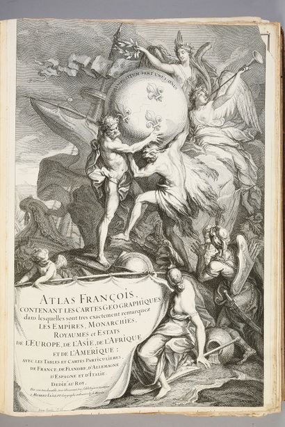
Manuscript frontispiece in black and red ink with mention of the date 1705: "Jaillot, Atlas François, contenant les cartes géographiques dans lesquelles sont très exactement remarquez les empires, monarchies, kingdoms et estats de l'Europe, de l'Asie, de l'Afrique et de l'Amérique: avec les tables et cartes particulières, de France, de Flandre, d'Allemagne, d'Espagne et d'Italie". Engraved title-frontispiece with a map of the world with a small lack at the top left, handwritten table in black ink.
Few scattered stains.
Volume 2
S.l.n.d. 2 volumes in-folio. Handwritten tables.
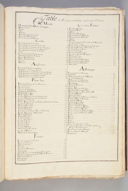
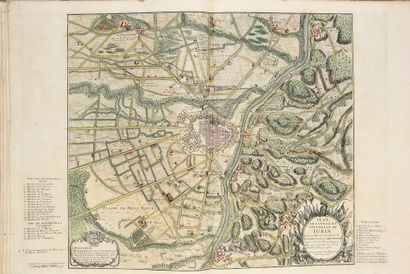
Collection of 211 maps mostly from the 17th century (46 maps from the 18th century)
Collation in conformity with the two manuscript tables, except for two missing maps. But Pastoureau underlines that the number of maps varies from one copy to another, because it often depended on Jaillot's stock at the time of the sale of the collection.
It should be noted that this set is richer than most of the known and referenced copies.
The maps are essentially by Mariette, Du-Val, Sanson, Chatillon, S. de Clerville and Baillieu.
Associated for a time with Guillaume Sanson, Alexis-Hubert Jaillot was appointed geographer to the king in 1686. He published his first atlas, the Atlas Nouveau, in 1681. He subsequently published numerous maps that can be found in the Atlas François, published in 1695, 1698 and 1700.
The number of maps is consistent with the copy described by Pastoureau under the entry JAILLOT II G.
Volume I includes:
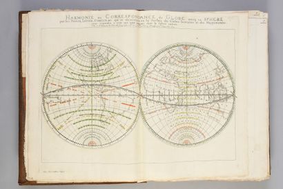
1 - Harmony of the sphere and the globe
2 - Mappemonde
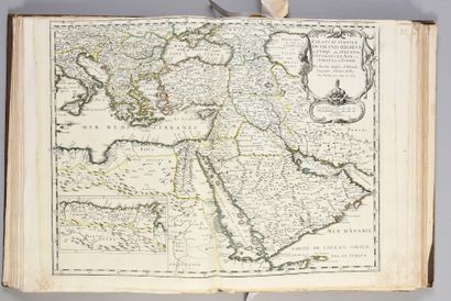
3, 4, 5 - Europe, Asia and Africa
6 - North America
7 - Southern America, 1
8 - Ocean near Europe
9 - General map of Scandinavia
10 - Norway - government of Wardus
11 - Norway - Dronthemhus
12 - Norway - Aggerhus
13 - Norway - Bahus
14 -Kingdom of Sweden
15 -Denmark
16 - Nort Jutland
17 - Denmark - South Jutland (Missing)
18 - South Jutland
19 - Livonia
20 - Muscovy
21 - general map of the 3 kingdoms of England
22 - England, northern provinces
23 - England, western provinces between North and South
24 - England, eastern provinces between North and South
25 - England, western provinces of the South
26 - England, eastern provinces of the South
27 - Table of division of the 17 provinces of the Netherlands
28 - The 17 provinces of the Netherlands
29 - United provinces of the Netherlands
30 - The Catholic Netherlands
31 - The Lordship of West-Friesland
32 - The Lordship of Groningen
33 - The Lordship of Ouer-Yssel
34 - County of Holland (northern part)
35 - County of Holland (southern part)
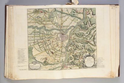
36 - The Lordship of Utrecht
37 - The Veluwe, the Betuwe, the county of Zutphé
38 - The county of Zeelande
39 - Dutch Brabant
40 - Spanish Gelderland
41 - French Flanders
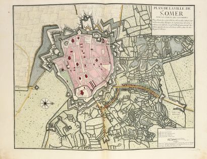
42 - The bishoprics of Saint Omer, Ypre and Tournay
43 - Spanish and Dutch Flanders
44 - Spanish Brabant
45 - Estates of Liege
46 - Limburg
47 - The county of Artois
48 - The bishopric of Arras
49 - The bishopric of Aire
50 - The county of Hainaut
51 - The Archbishopric of Cambrai
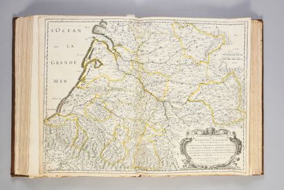
52 - The county of Namur
53 - The Duchy of Luxembourg
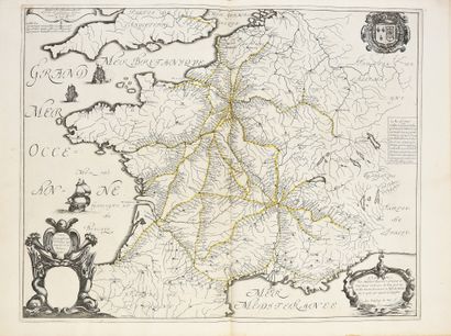
54 - France
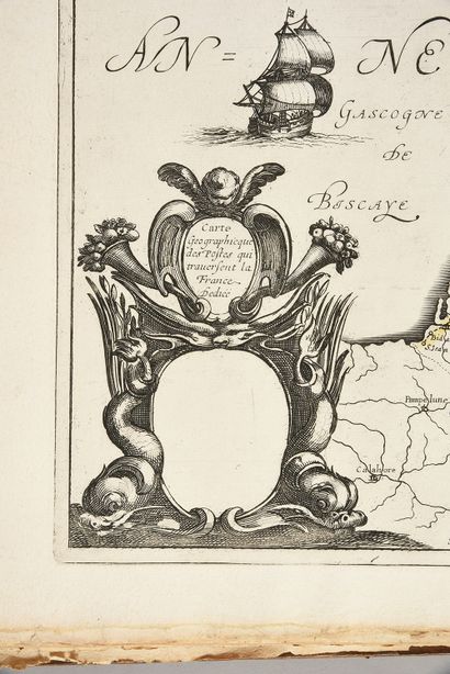
55 - Rivers of France (1641)
56 - The posts of France
57 - Picardy
58 - The bishopric of Boulogne
59 - Normandy
60 - Isle of France, Champagne, Lorraine
61 - The Isle of France
62 - Election of Paris
63 - Champagne
64 - Lorraine
65 - The bishopric of Verdun
66 - The bishopric of Metz
67 - The Alsace
68 - The bishopric of Strasbourg
69 - The government of Brittany
70 - The government of Orleans
71 - The Anjou
72 - The Beauce
73 - The two Burgundies
74 - Franche-Comté
75 - Guyenne and Gascony
76 - County of La Rochelle and Oléron Sieur de Chatillon
77 - Côtes du Poitou, Aunis and La Rochelle and Ile de Ré
<
My orders
Sale information
Sales conditions
Return to catalogue